
| Google Maps 360 Panoramas of the Marieta Islands Jorge Jimenez - CVB of Riviera Nayarit | |
June 4, 2015 |
 |
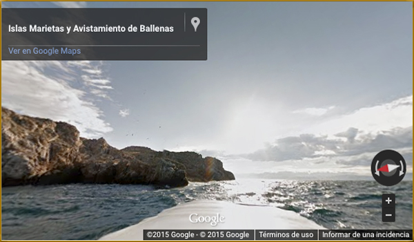
The most recent 360° images on Google Maps’ famous application capture the Islas Marietas — one of the Riviera Nayarit’s most famous icons — placing them among the “Top Spots In Mexico.”
Now Web users will be able to see this marvelous location in Mexico’s Pacific Treasure with just one click.
The Marina Riviera Nayarit in la Cruz de Huanacaxtle was also recently added to the app, as well as other attractions including Sayulita and San Pancho — all part of this special list of beautiful places.
Check it out!
The Islas Marietas
The Marina Riviera Nayarit
This content was submitted by a member of the community. We'd like to hear from you, too! To share stories, photos, video or events, please send them here.
We invite you to add your charity or supporting organizations' news stories and coming events to PVAngels so we can share them with the world. Do it now!
From the Bay & Beyond
Celebrate a Healthy Lifestyle
 From activities like hiking, swimming, bike riding and yoga, to restaurants offering healthy menus, Vallarta-Nayarit is the ideal place to continue - or start - your healthy lifestyle routine.
 Banderas Bay offers 34 miles of incomparable coastline in the states of Jalisco and Nayarit, and home to Puerto Vallarta and Riviera Nayarit's many great destinations.