
| Mexico Leading the Way on Satellite, Drone Use in Agriculture and Fisheries ThePoultrySite | |
| go to original August 8, 2015 |
 |
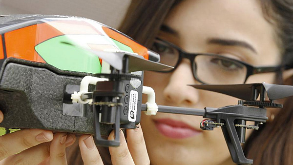
Mexican Quesney Nevarez’s 3D printed farming drone, a summer project she has undertaken while participating in a 12-week summer project at Carleton University in Ottawa. See story link below (3DPrint.com)
Mexican officials say the country is at the 'forefront' of technology use in agriculture and fisheries, allowing a more precise analysis of the sectors.
The drones and satellites have been used to strengthen monitoring of fields and seas in order to have timely and reliable information on the performance of the primary sector, according to Patricia Ruiz Ornelas, the director in chief of the Agricultural Information and Service Fisheries (SIAP).
Speaking at the conference 'Geospatial Solutions for the Agrifood Sector', Ms Ornelas said that the data was collected for use in planning the future of the the food industry by the Secretariat for agriculture and fisheries (SAGARPA).
Javier Aguilar Vicente Lara, also from SIAP, explained how the technology is used, saying that the licence agreement allows the agency to provide enough images to federal, state and municipal governments, to have a daily satellite monitoring of agricultural land and fishing areas.
Read the rest at ThePoultrySite
Related: 3D Printed Farm Drone Designed by Mexican Engineering Student Helps Small Farmers Monitor Crops (3DPrint.com)
We invite you to add your charity or supporting organizations' news stories and coming events to PVAngels so we can share them with the world. Do it now!
Celebrate a Healthy Lifestyle
 From activities like hiking, swimming, bike riding and yoga, to restaurants offering healthy menus, Vallarta-Nayarit is the ideal place to continue - or start - your healthy lifestyle routine.
 Banderas Bay offers 34 miles of incomparable coastline in the states of Jalisco and Nayarit, and home to Puerto Vallarta and Riviera Nayarit's many great destinations.